A. Background
Bailang River is the principle river of Weifang City in Shandong Province, as the south-north greening axis across the city. Since 1949, 60 years of economic growth and industrial activity have adversely affected the Bailang River: (1) the industrial effluents, domestic sewage, and initial precipitation discharging in the river directly; (2) due to the damage of dyke, the functions of ecological protection and supporting social and economic development have been declined or even disappeared with poor flood protection ability which does not fulfill the national requirement; and (3) with the urbanization of Weifang, the banks of this river have rapidly become the prosperous area of this city in the future.
Respond to the 3 items, municipal government decided to carry out overall comprehensive improvement and renovation of the river, banks, and surrounding areas of Bailang River, in terms of Landscape Planning and Design of Beichen Oasis at Downstream of Bailang River.
B. Overview
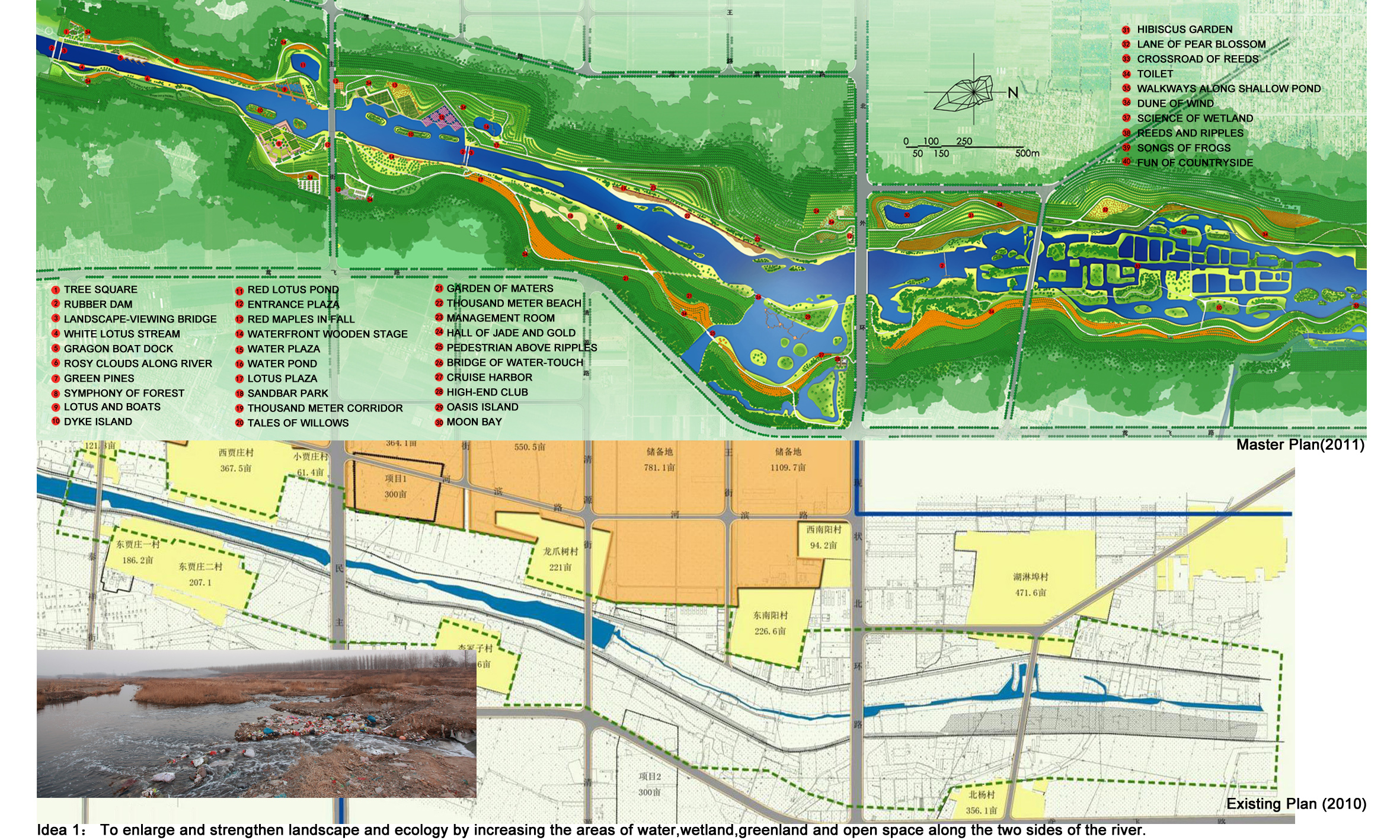
This project located in the downstream of Bailang River (full length of 87 km), with planning length of 6 km, width various from 200 meters to 500 meters, average width of 500 meters and depth of 2 to 3 meters. The area of water body is 25 hm2. Most of the existing plants of bank area are poplars, covering half of the site area with the age from 20 to 40 years old. Within the planning, the original dyke has been relocation outward, expanding the water body area to 80 hm2, and digging the riverbed 2 to 4 meters lower to remove the polluted soil on the riverbed, thus deepening the water to 4 to 6 meters. 90 percent of current plants has been kept and 150 hm2 greening with totally hundreds types of greening species planted.
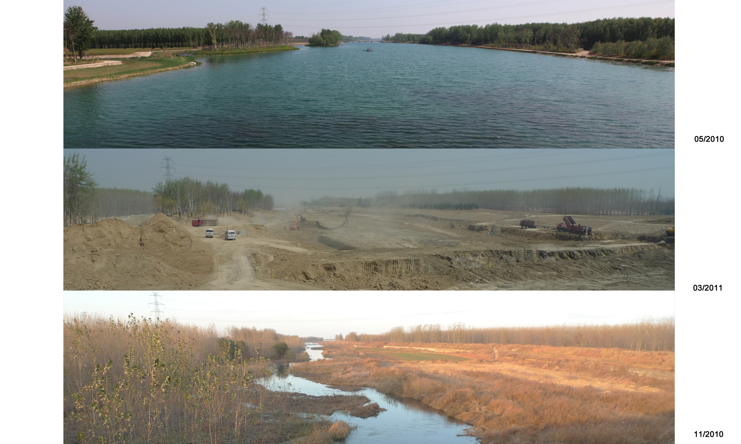
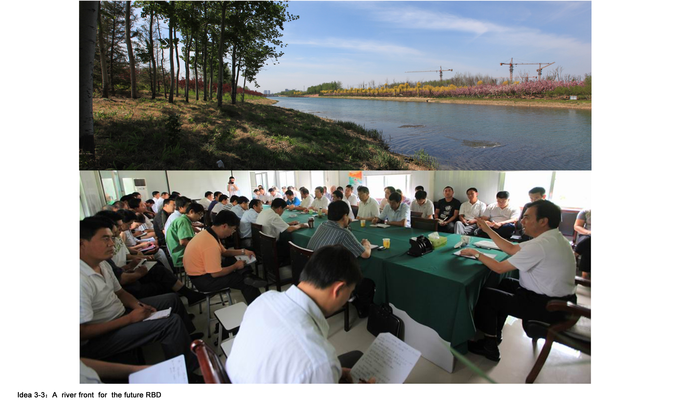
Since Septenmber of 2009, under progress in various phases of conceptual planning, detailed construction planning, schematic design, design development, construction drawings, and site construction guidance by design team, the project’s construction phase started in April 2011 till the initial build-up in May 2013, with a total investment of 1.5 billion RMB (land-use and building removal compensation fees excluded).
C. Concepts Creation
Besides the common requirement of riverside waterfront landscape planning and design, this project aims at the consideration and creative breakthrough in current prominent issues in urban riverside waterfront landscape planning and design.
3.1 Philosophy I: Bigger and stronger landscape ecology - Urban riverside waterfront development with the guidance of landscape architecture
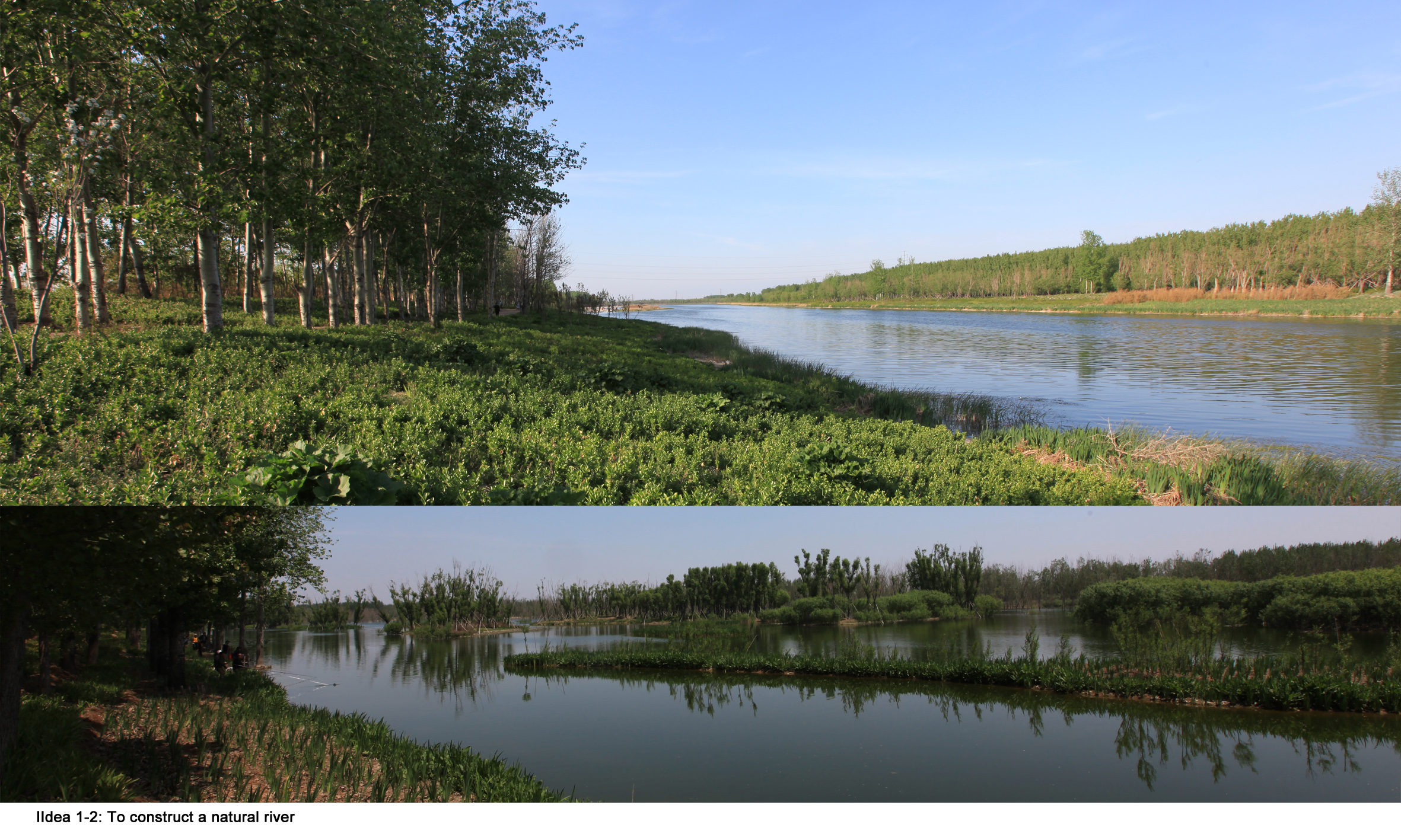
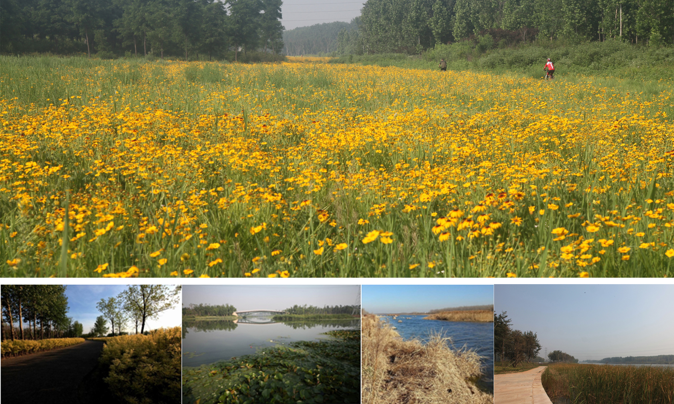
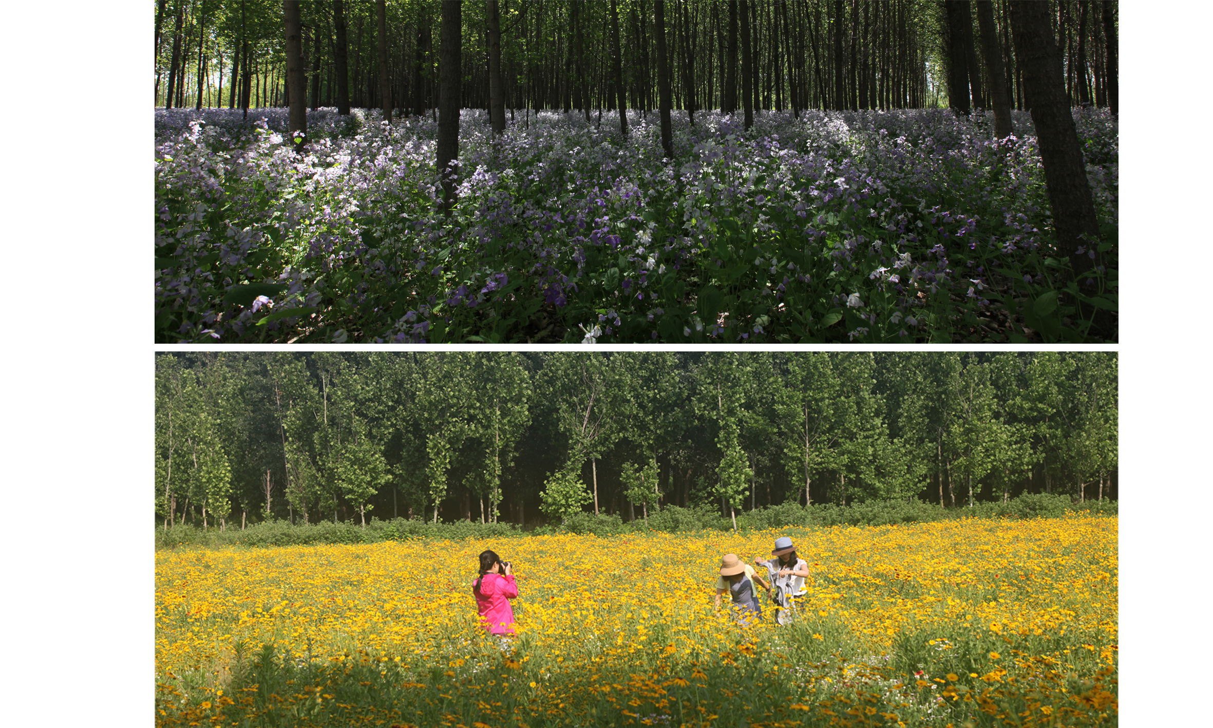
Forest with populars are on the both side of the banks with an original greenland coverage of 50%. After the construction, the coverage raised to 90%, and half of the original greenland were 90% conserved. Some of the old aged populars have been substituted, amount to 10% of the original forest. The newly planted 100,000 trees are mainly native species, forming local plant community combined with shrubs and herbs. The boundary between flood dyke expansion and natural pattern has been blurred into an “grand landscape ” with the length of 1200 meters and width of 300 to 400 meters to express the concept of “urban waterfront getting back to nature and natural green getting into the city”. In addition, within the 8 kilometer riverside, except for the “waterfront beach”, the relocated and renovated banks are both soft gentle slope ecological revetment, with the coverage of shrubs, herbs, and trees, and aquatic plants in the neighboring and shallow water.
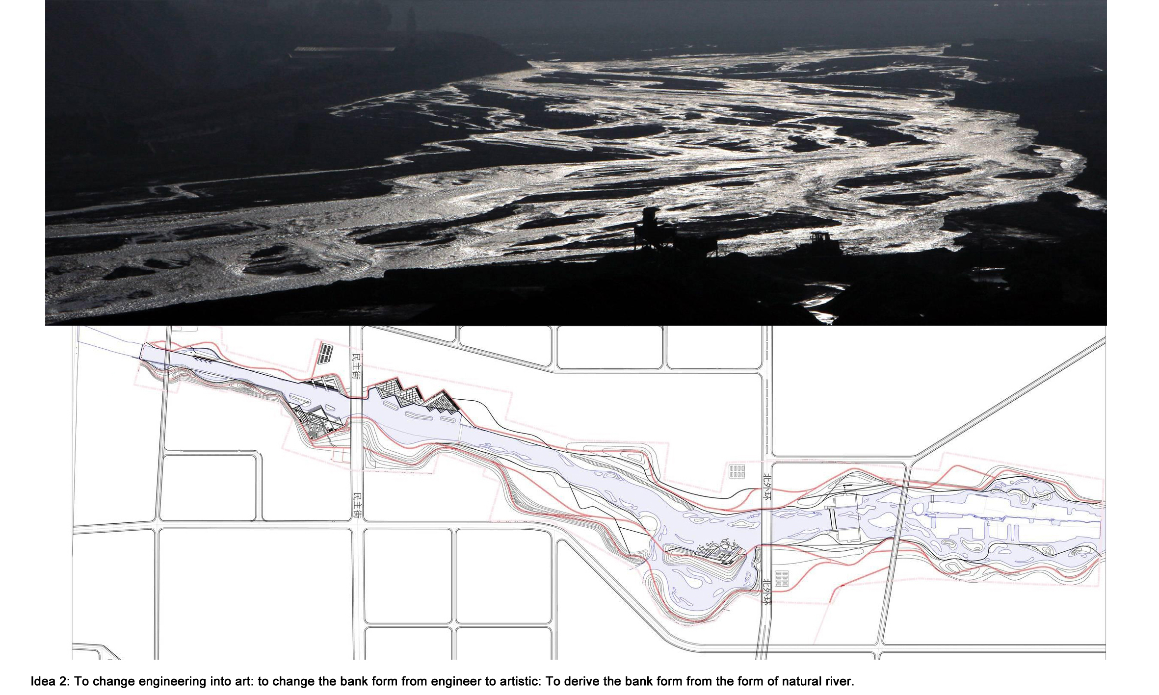
3.2 Philosophy II: From engineering river dykes to landscape fine art - change the traditional engineering shape of flood dyke to create naturally artistic landscape dynamic waterfront space
With the spirit from natural river to create landscape space art and a liberal curving revetment, the dynamic landscape feeling of direction and fluidity has been created. Under urban flooding requirement, paralleled and canalized dykes have been changed into artistic design with outward relocation of dykes in order to weaken the paralleled and inflexible formation of traditional engineering dykes. Horizontally, using large scale and micro curving dyke, in harmony with the natural topography to blur the single dyke boundary. Vertically, within the elevation of dyke for flooding control, various elevations can make the dykes more flexible, meandering into the natural greenland to transform into landscape “art” rather than hydraulic “engineering”. Also, the paradox of two huge sewage box culverts (section: 3m height X 4m width) and ideal river bank line has been resolved.
3.3 Philosophy III: Public space for future waterfront leisure experience and urban culture memory - Spaces for RBD on the banks in the city’s future
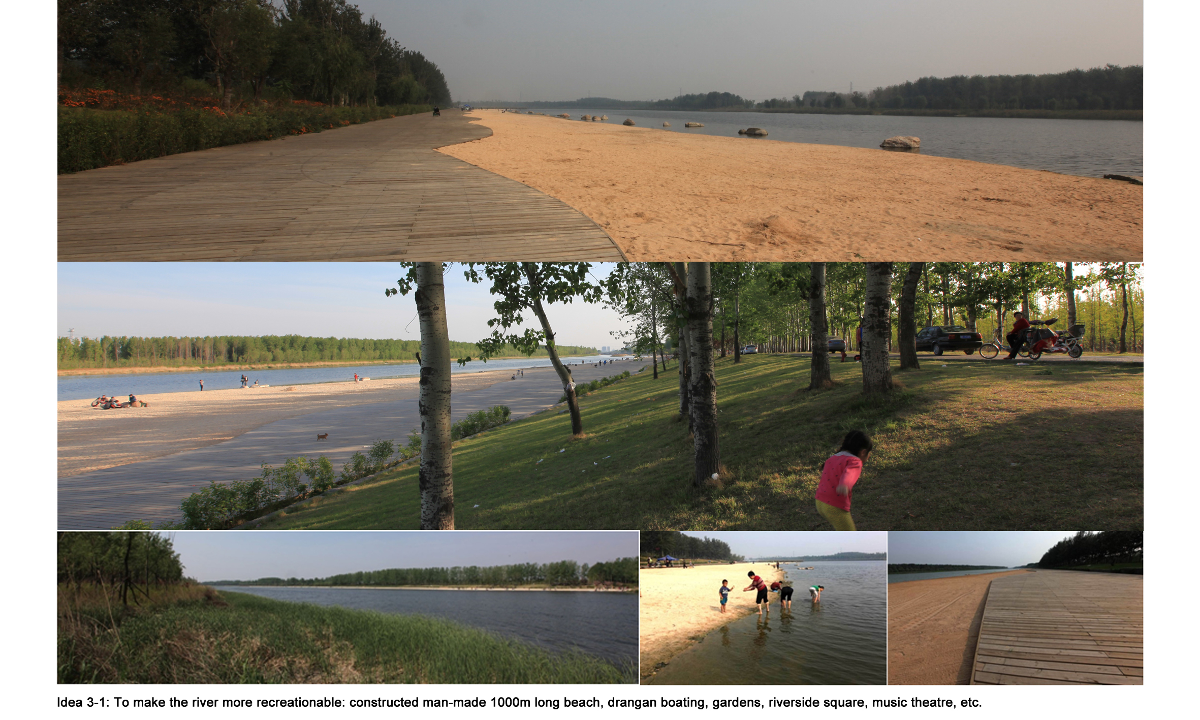
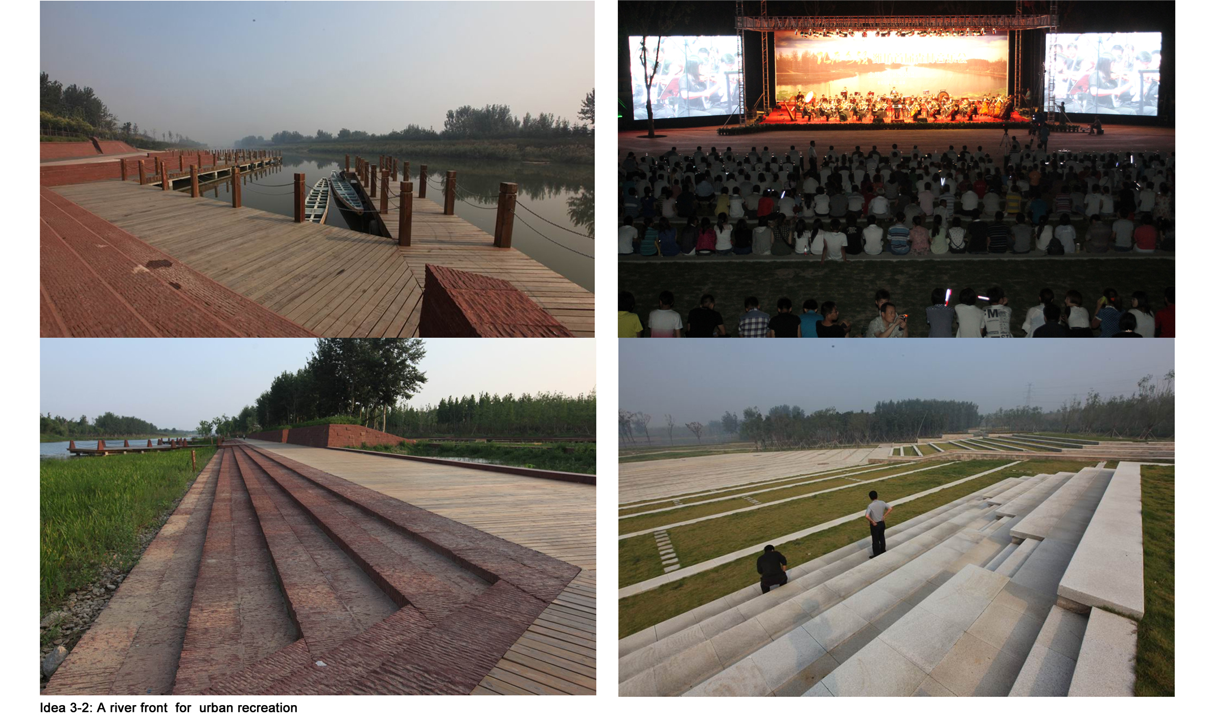
As the river across the city, this river also conducts the function of tourism and hospitality to create abundant waterfront space and entertaining area. Thus, public spaces for desiring and entertaining as “grand landscape”, “thousands meter man-made beach”, “forest orchestra plaza”, “dragon boat race dock”, “wetland fishing”, and “lotus fairyland” have been constructed. As the cradle of Weifang’s city history and culture, this part of river is not only the green ecological corridor for citizens’ pastime but also the important place for cultural memory of Weifang City.
And, as the construction 160 year ago of Central Park in Manhattan, this projects will become RBD for the city in the near future of 5 - 10 years. The waterfront ecological environment proposed by this part of river improves the urban land value on the banks as the guidance of urban development, expressing a new urbanization planning concept in new stage of China as “development follows environment”.
| Tipologia | Espai fluvial |
| Promotor | Weifang Three Rivers investment & Managment Company,Shandong Province |
| Promoció | P?ca |
| Localització | Xina |
| Àrea | 5000000 m² |
| Cost | 4,48 €/m² |
| Any inici | 2012 |
| Any finalització | 2013 |